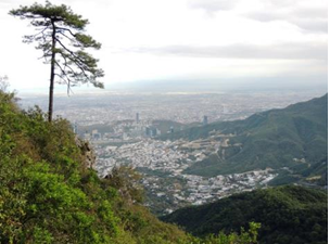
Dinâmica de mudança nos ecossistemas urbanos e peri-urbanos na área metropolitana de Monterrey, México
##plugins.themes.bootstrap3.article.main##
Resumo
Downloads
##plugins.themes.bootstrap3.article.details##

Este trabalho encontra-se publicado com a Creative Commons Atribuição-NãoComercial 4.0.
Referências
ARDILA, J. P., BIJKER, W., TOLPEKIN, V. A. y STEIN, A. 2012. Multitemporal change detection of urban trees using localized region-based active contours in VHR images. Remote Sensing of Environment 124: 413-426. DOI: https://doi.org/org/10.1016/j.rse.2012.05.027
ARENAS, S., HAEGER, J. F. y JORDANO, D. 2011. Aplicación de técnicas de teledetección y GIS sobre imágenes Quickbird para identificar y mapear individuos de peral silvestre (Pyrus bourgeana) en bosque esclerófilo mediterráneo. Revista de Teledetección [En línea] 35: 55-71. [Consulta 12 de mayo 2021]. Disponible en: http://www.aet.org.es/revistas/revista35/Numero35_07.pdf
AZZARI, G., JAIN, M. y LOBELL, D. B. 2017. Towards fine resolution global maps of crop yields: Testing multiple methods and satellites in three countries. Remote Sensing of Environment. 202: 129-141. DOI. https://doi.org/org/10.1016/j.rse.2017.04.014
BALLINAS, M y BARRADAS, V. L. 2015. The Urban Tree as a Tool to Mitigate the Urban Heat Island in Mexico City: A Simple Phenomenological Model. Journal of Environmental Quality. 25: 1-10. DOI: https://doi.org/10.2134/jeq2015.01.0056
BASCUÑÁN, F., WALKER, P. y MASTRANTONIO, J. 2009. Indicadores de diversidad e integración socioeconómica de ciudadanos en espacios urbanos de uso público. Urbano. [En línea] 19: 43-51. [Consulta 12 de junio 2021]. Disponible en: http://revistas.ubiobio.cl/index.php/RU/article/view/334
EVERITT, J. H., YANG, C. y JOHNSON, H. B. 2007. Canopy spectra and remote sensing of Ashe juniper and associated vegetation. Environmental Monitoring and Assessment 130: 403-413. DOI: https://doi.org/10.1007/s10661-006-9407-2
FULLER, R. A. y GASTÓN, K. J. 2009. The scaling of green space coverage in European cities. Biology Letters. 5: 352-355. DOI: https://doi.org/10.1098/rsbl.2009.0010
GIRI, C., PENGRA, B., ZHU, Z., SINGH, A. y TIESZEN, L. L. 2007. Monitoring mangrove forest dynamics of the Sundarbans in Bangladesh and India using multi-temporal satellite data from 1973 to 2000. Estuarine, Coastal and Shelf Science 73: 91-100. DOI: https://doi.org/org/10.1016/j.ecss.2006.12.019
JUMB, V., SOHANI, M. y SHRIVAS, A. 2014. Color image segmentation using K-means clustering and Otsu's adaptive thresholding. International Journal of Innovative Technology and Exploring Engineering [En línea]. 3 (9): 72-76. [Consulta 01 de enero de 2021]. Disponible en: http://www.ijitee.org/wp-content/uploads/papers/v3i9/I1495023914.pdf.
MACGREGOR-FORS, I., ORTEGA-ÁLVAREZ, R. y SCHONDUBE, J. E. 2009. On the ecological quality of urban systems: an ornithological perspective. In: Urban planning in the 21st century. D.S. Graber y K.A. Birmingham (eds.). Nova Science Publishing. 51-66. ISBN:978-1-60692-975-9
MEJÍA S, G. y GÓMEZ, R. 2015. Un análisis a la superficie de área verde por habitante en la ciudad de Tepic, Nayarit, México. Investigación Joven. 2: 1-5. ISSN 2314-3991
MENDES, D. F., DA SILVA, S. F., FERRERI, J. L., DOS SANTOS, A. R. y GARCÍA, R. F. 2015. Acurácia temática do classificador por máxima verossimilhança em imagem de alta resolução espacial do satélite Geoeye-1. Nucleus. 12: 107-118. DOI: https://doi.org/10.37378/1982.2278.1011
MEZA A, M DEL C y MONCADA M, J. O. 2010. Las áreas verdes de la ciudad de México. Un reto actual. Scripta Nova. Revista Electrónica de Geografía y Ciencias Sociales. 331 (56). ISSN: 1138-9788.
NOWAK, D. J., CRANE, D. E. y STEVENS, J. C. 2006. Air pollution removal by urban trees and shrubs in the United States. Urban Forestry & Urban Greening. 4: 115-123. DOI: https://doi.org/10.1016/j.ufug.2006.01.007
PALACIO-PRIETO J. L., SÁNCHEZ-SALAZAR, T. M., CASADO-IZQUIERDO, J. M., PROPIN-FREJOMIL, E., DELGADO-CAMPOS, J., VELÁZQUEZ-MONTES, A., CHIAS-BECERRIL, L., ORTIZ-ÁLVAREZ, M. I., GONZÁLEZ-SÁNCHEZ, J., NEGRETE-FERNÁNDEZ, G., GABRIEL-MORALES, J. y MÁRQUEZ-HUITZIL, R. 2004. Indicadores para la Caracterización y Ordenamiento del Territorio. Instituto Nacional de Ecología-SEMARNAT, Instituto de Geografía de la UNAM y Secretaría de Desarrollo Social. Convenio SEDESOL-Instituto de Geografía, UNAM. México, D.F., México. 161 p.
RASHMI C., CHALUVAIAH, S. y KUMAR, G. H. 2016. An efficient parallel block processing approach for K-means algorithm for high resolution orthoimagery satellite images. Procedia Computer Science, 89, 623-631. DOI: https://doi.org/10.1016/j.procs.2016.06.025
USGS, 2021. U.S. Geological Survey. [En línea]. [Consulta 15 de julio de 2021]. Disponible en: https://earthexplorer.usgs.gov/


